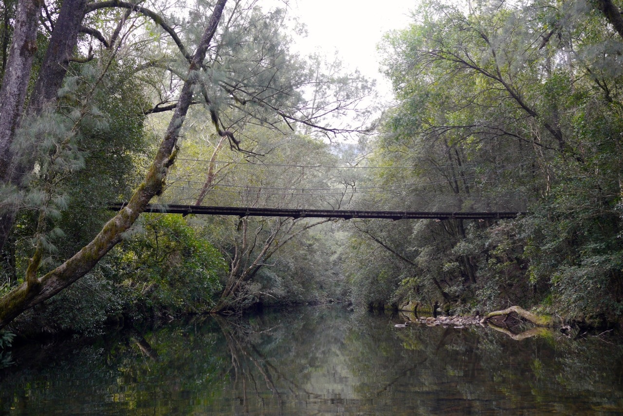
This little challenge is subtle but powerful – how much do you know about the water that flows by where you live? How much do you know about where it comes from, and where it flows to?
Once, our waterways were intrinsic to our communities’ health – on a practical, day-to-day basis. Water is life, after all.
To take on this simple Permaculture Living challenge, you’ll start by re-learning about your waterways. No matter how urban your local ‘hood is, we can deepen our sense of connection to place, and all that flows from that.
Learning your local waterways might involve maps, some internet research, or your feet, and a commitment of time – can you walk your local waterway (or it’s path, if it’s underground for some sections) for an afternoon, or a day?
Where does the water (or it’s path, if your local waterway is dry right now) go? Where does it come from?
And what does your local waterway’s current state of health reflect about your community, and your place?
This is an exercise in observation. interaction, and discovery – that will reveal all sorts of things about your place – in a not dissimilar way to learning about the wild plants where you live.
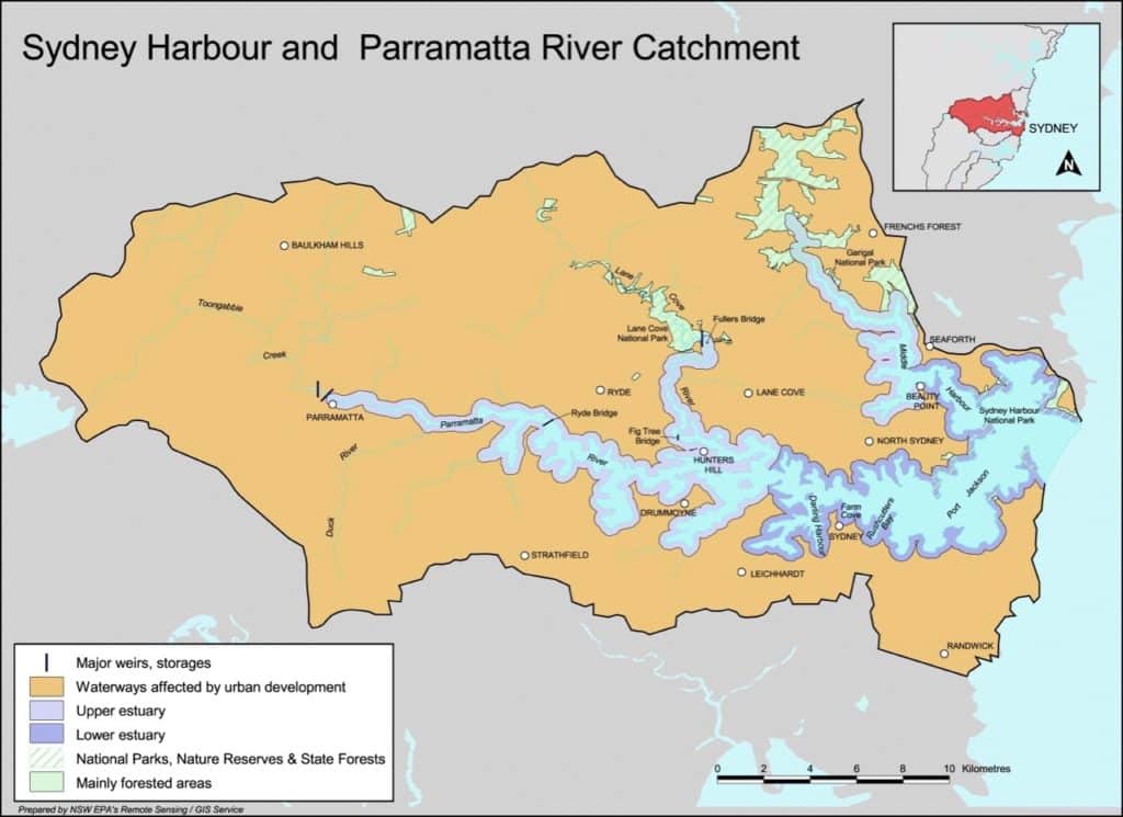
Defining your local watershed / catchment
First of all, figure out what the bounds of your local watershed, or local catchment, actually is:
A catchment is an area of land where water collects when it rains, often bounded by hills. As the water flows over the landscape it finds its way into streams and down into the soil, eventually feeding the river. Some of this water stays underground and continues to slowly feed the river in times of low rainfall. Every inch of land on the Earth forms part of a catchment. – Georges Riverkeeper
If you do an online search of the name of your nearest city and the word ‘catchment’, you’ll usually find local council pages with information on your area.
Then, get an aerial map, or look one up online, and spend time getting to know your catchment. Where are the ridge lines, the highest points in the landscape? What creeks flow down from them? What about the rivers?
Identify elements that you are familiar with; the bridge you cross on your way to work, or the gully that you harvest blackberry in over autumn. Link what you see on the map with what you know to be the case on the ground.
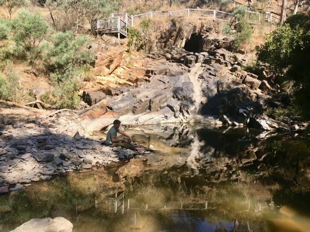
Getting to know your waterways
Once you’ve familiarised yourself with your catchment and where it is, see if you can find out the original names of your waterways – names from the people who have been the waterkeepers of your area, in the past and into the future.
In some places this will be easier to figure out than in others. In some places, the names of your waterways will have changed over time, and will reveal all sorts of things about the ecosystems and people who have lived alongside them over the years.
If you can’t find out a name for your local creek, consider giving it a private name – one that means something to you, and the place where you live.
Then get out there and say hello to your local waterway. Introduce yourself, if you like. Go for a walk or bike ride along your local river or creek, or plan to walk a few hours of it in each direction.
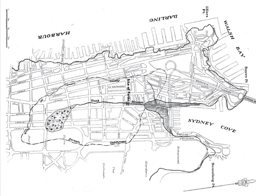
But my local creek is underneath a street now!
In an urban landscape? No problem. Your waterways are still there, even if they are partially (or sometimes even entirely) submerged beneath concrete.
Learn where the waterways come from, and where they lead to, and walk your waterway regardless. This is your place, so get to know it. Some cities have historic walks that follow submerged waterways, so poke around and see what you can come up with.
Once you’ve defined your local waterways…
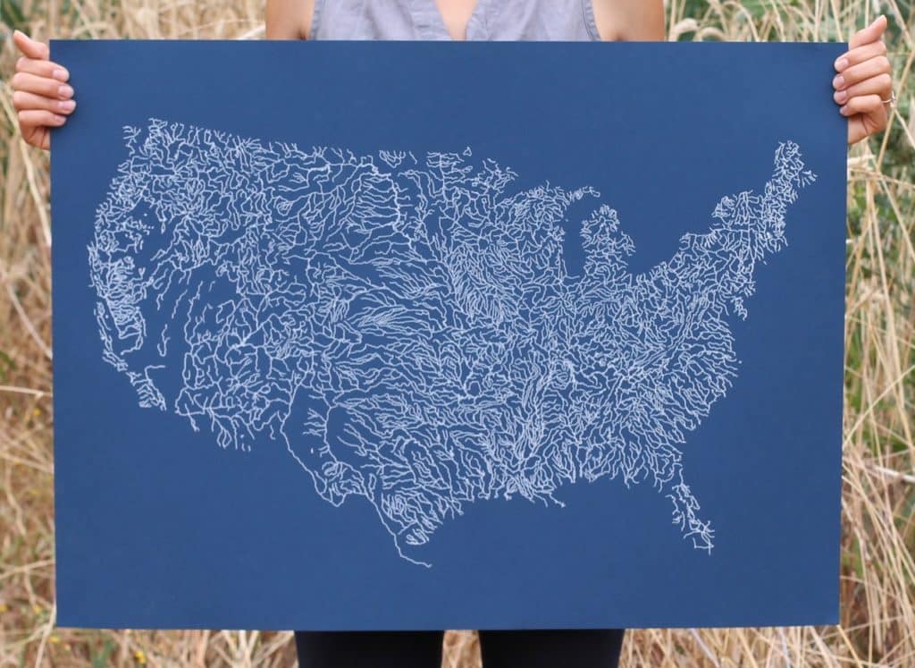
Continue to observe, and interact. Take note of how the waterways change over the seasons, and after heavy rain. Draw up a map of you waterways and put it up in your house.
Tell your friends and/or kids about what you’ve learned, and where the water flows from and to. Sharing what you learn is valuable. We all benefit from this knowing and this sense of place.
Consider what the health of your waterways means for ecosystems and communities downstream – how can you contribute to your waterways health?
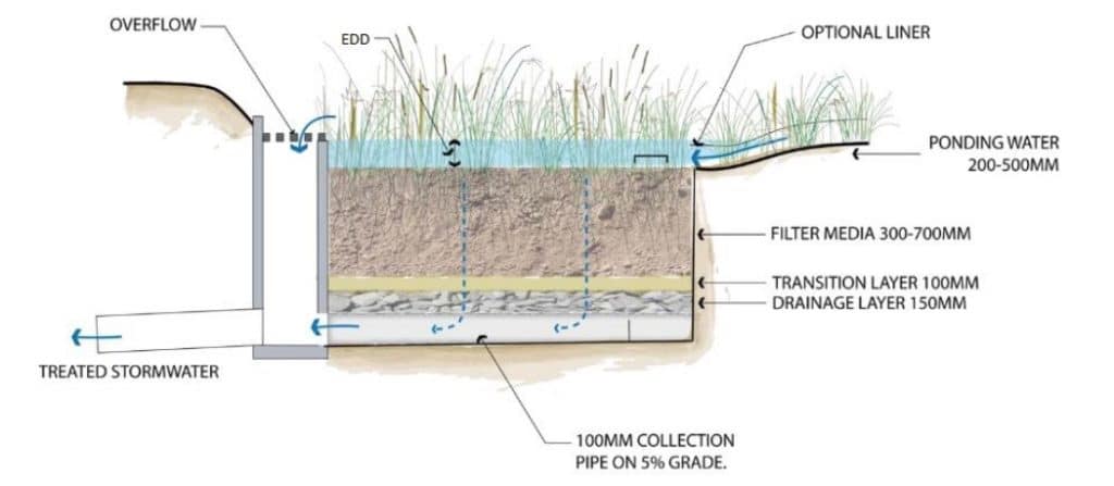
There’s often community groups that work to clean up waterways, and there’s HEAPS of ways that you can help ensure that your stormwater leaves your property as clean as possible, before it enters and joins your local stream.
You might look into creating a stormwater/rainwater garden to help filter stormwater before it flows into your local catchment, or maybe you will opt for just picking up rubbish in the street so it doesn’t end up in the gutter, which then flows down and into your local river.
Hey, wait a minute – where does the water from my sink and shower go? Well, it goes to a variety of places, depending where you live, but it all winds up in either in your local water table, waterways, or ocean. What kind of biosphere-safe soaps and detergents can you use (or make), to minimise your impact in this way?
Do whatever you can that is within your scope – this is all part of caring for your watershed.
And, even if you only opt for talking and discussing what you’ve learned about your local waterways, this observing and interacting will add richness to your daily routine, and depth to your understanding of your place.
Please let us know how you go, we’d love to hear how you get on.
This challenge is part of our Permaculture Living series – one everyday climate action for you each week. Make sure you’re on our newsletter so you get notified of all the goodness!
Resources
- What is a Catchment, Water NSW – definitions and teacher and student resources
- Walking Upstream – an art project about walking local waterways, by our friend Lucas (and the project’s book in pdf!)
- Hidden Waters – great blog (and book) about paved-over waterways, worldwide
- Raingarden resources – Melbourne Water
- The Mudcrabs – community group dedicated to cleaning up the Cooks River
- ‘Daylighting’ urban rivers – a worldwide movement of regeneration
- Hidden Nature – by Alys Fowler – kayaking Birmingham’s canal network
- Let The Water Do The Work – a classic text in riparian restoration (think like a river) by Bill Zee Dyk
- Natural Sequence Farming – Peter Andrews work in re-hydrating landscapes by paying attention to the watershed
- Watershed Restoration – a bunch of resources from our time doing on-farm riparian restoration
- How to Read Water: Clues and Patterns from Puddles to the Sea, by Tristan Gooley – hundreds of techniques on how to read water
The above is an snippet of our Permaculture Living online course – a 12 week, interactive, in-depth program that will take you from ‘hmm, that sounds like a good idea’ to a version of yourself who is FULL of new projects, habits and knowledge – and motivated to start making life better. Better for you, for your ecosystem, and for our planet, too.



Great post. It was you lot that got me thinking about waterways, I think at a Milkwood “icebreaker” where you asked everyone to identify their local waterway. At the time (I was living in Petersham, Sydney) it was “poor old Johnstons Creek” a concrete-lined drain that runs through the edge of Annandale/Glebe. Then when we moved to Wollongong, I noticed creeks everywhere! And started working with fellow artists Kim Williams and Brogan Bunt on the Walking Upstream project. We made a book about 12 of the local creeks. Here’s a downloadable version: http://walking-upstream.net/wp-content/uploads/2018/04/12_Creek_Walks.pdf Watershed / Catchment scale thinking is really… Read more »
I moved from the city (water waste to treatment plant to ocean) to the country (waste to septic system to the local water table). I’ve decided to research how truly biodegradable the personal care products are that go into our septic. We’ve been really careful about cleaning products (for years I’ve made my own universal cleaner – for everything except glass – out of baking soda, biodegradable dish soap and enough liquid glycerin to make it spreadable like cake frosting), but I don’t trust the personal care products I buy because, at least in Canada, it’s a completely unregulated industry… Read more »
James Nash found gold in a creek in Gympie. History books record that the site is where the Town Hall now sits, no creek to be seen. It is at the bottom of three large hills, the Palatine, Caledonian and Calton Hills. If you look at the hills, despite the building and roads, you can see the ridges and gullies. If you turn around and face towards the Mary River, and half-close your eyes just so, you can imagine/see where that old creek used to run. My place is further around and towards the bottom of the Palatine – look… Read more »