")
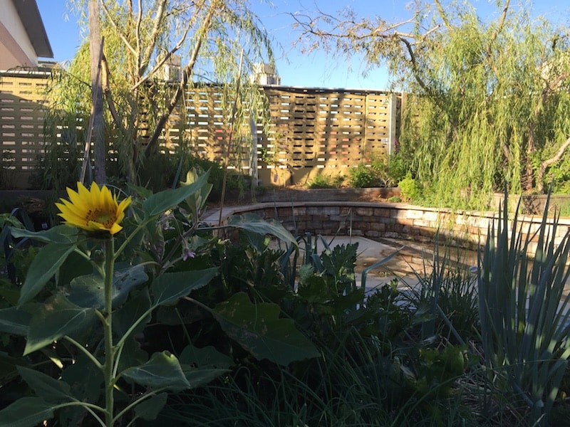
When you’re creating a permaculture design, mapping where the sun falls on your site at different times of the year is central.
Why? Because plants need sun.
If you want healthy veggies or sweet fruit, you need to place your gardens, greenhouses and orchards where they will get adequate sunshine for the parts of the year that they are growing or fruiting.
And that’s not all.
This how-to is part of the resources from our Permaculture Living online course with Milkwood founders Kirsten Bradley & Nick Ritar & permaculture co-originator David Holmgren . If you want to design a resilient future & permaculture life for yourself, bring it on, we’re ready to help you get the skills.
Other elements of your permaculture design need sun too.
Solar panels need maximum exposure to the sun to harvest the most energy they can.
Solar hot water panels are exactly the same and every home outside the tropics can benefit from having more winter sunlight entering the living spaces.
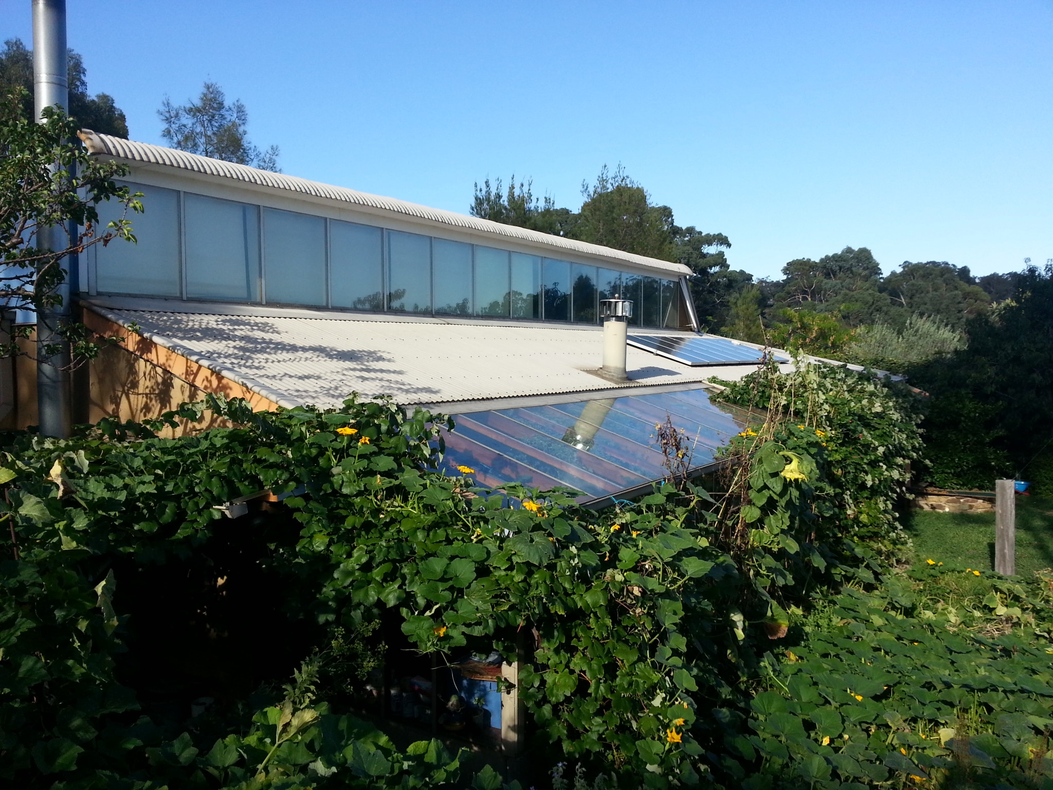
It’s not just our gardens and our homes that can benefit from thoughtful solar design, animals like winter warmth and summer shade too.
Beehives, chickens, fish ponds, livestock and even our family pets appreciate sunshine in winter and shade in summer.
If you want to maximise plant productivity, minimise your energy use and ensure everyone is comfortable all year round your permaculture design must take into account the position of the sun in the sky.
By creating even a basic map that shows the areas of year-round shade and year round sunshine you can place of all kinds of elements into your design with confidence
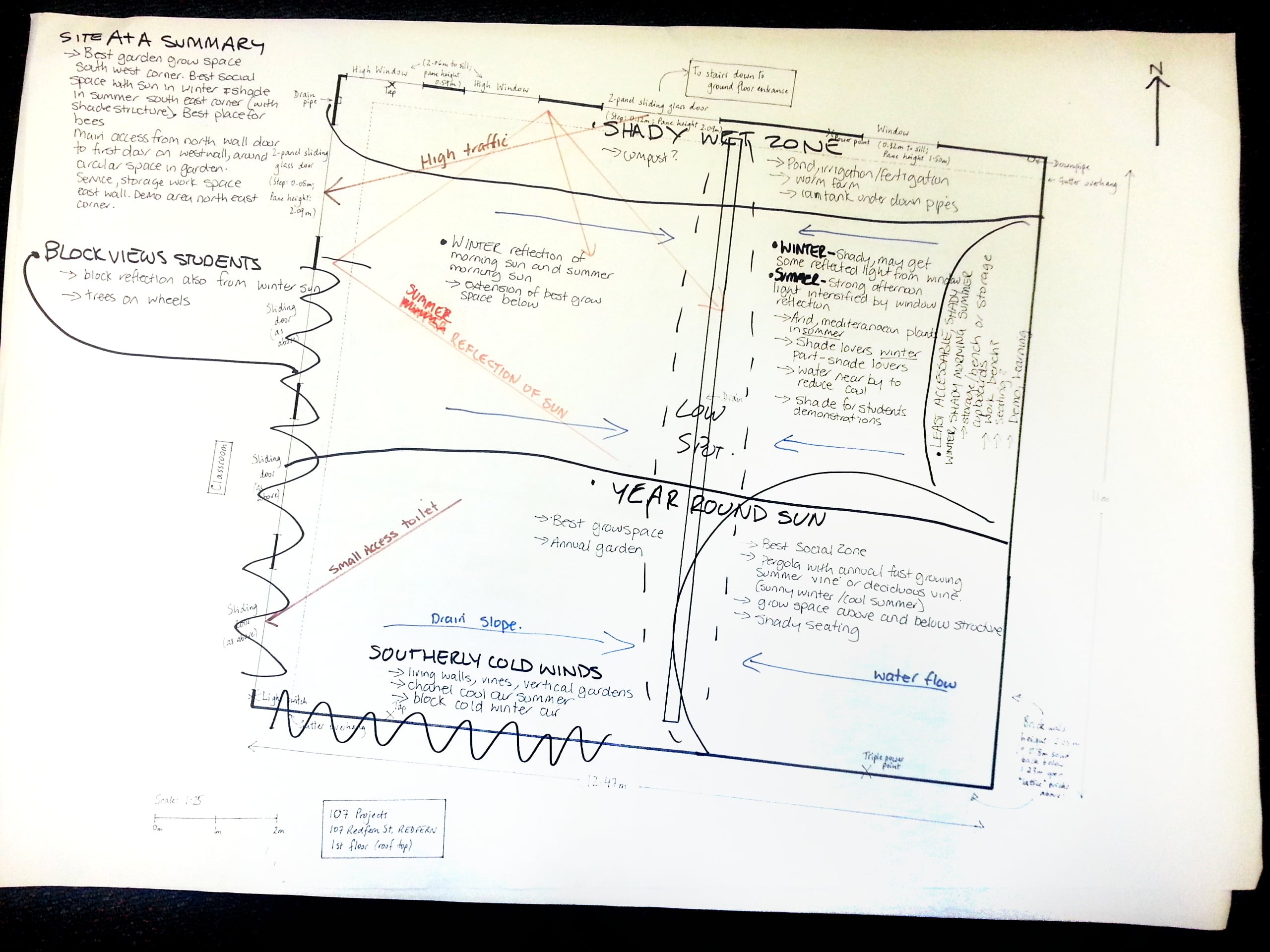
But how do you find out where the sun moves in relation to your garden & home.
Here are seven of the best ways we know to better understand the movement of the sun at your place.
1. Go outside and observe
Take a camera with you and photograph your site at mid morning, noon and mid afternoon at midsummer and mid winter.
Take note of where the shadows are and which part of your garden is in shade and which part is in sun.
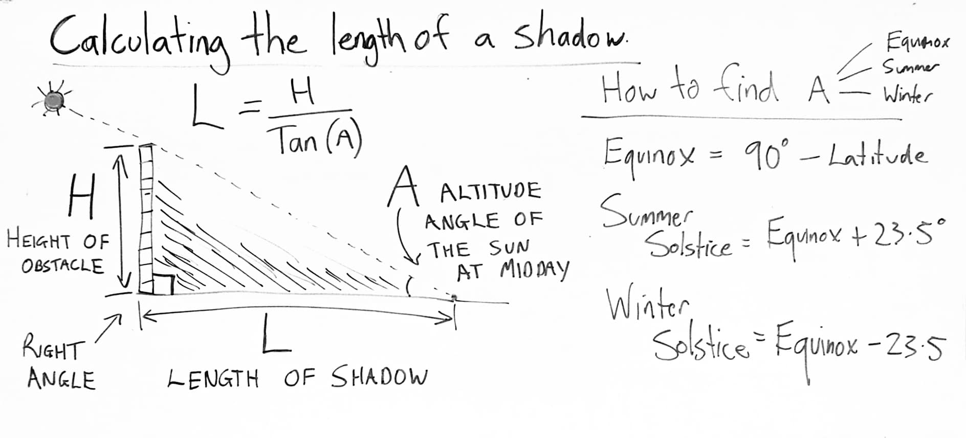
2. Do some maths
By taking a few measurements you can calculate the exact length (L) of the shadow cast at midday by any object such as a tree, wall or building.
With the formula above all you need to know is H (the height of the thing casting the shadow) and A (the angle of the sun at midday).
You can calculate A at the equinox, summer solstice and winter solstice using the second set of formulae if you know your latitude (the number of degrees north or south of the equator that your site is).
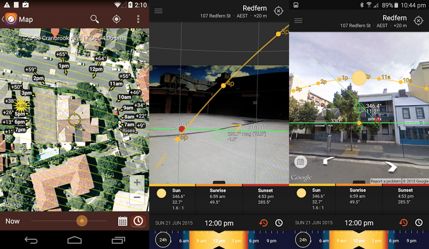
3. Use an app on your smartphone
There are some fantastic apps to help you locate the path of the sun all year round. Two of the best are:
These apps use your phones GPS and compass to display an accurate representation of the sun’s path through the sky in your location.
Both apps have 3D augmented reality camera overlays as well as integrations with Google maps.
4. Use an online tool
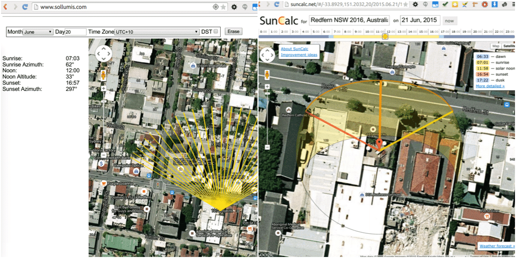
There are several good online tools for visualising the path of the sun at your location.
SunCalc – really easy to use and gives you an intuitive representation of the suns path laid over a google maps image of your site. Like most of these options you can generate a diagram for any time of the year.
Sollimus – provides a similar service, again based on Google maps. It’s use a different way of representing the sun’s light shining on a point – some people will find this tool more intuitive than Suncalc.
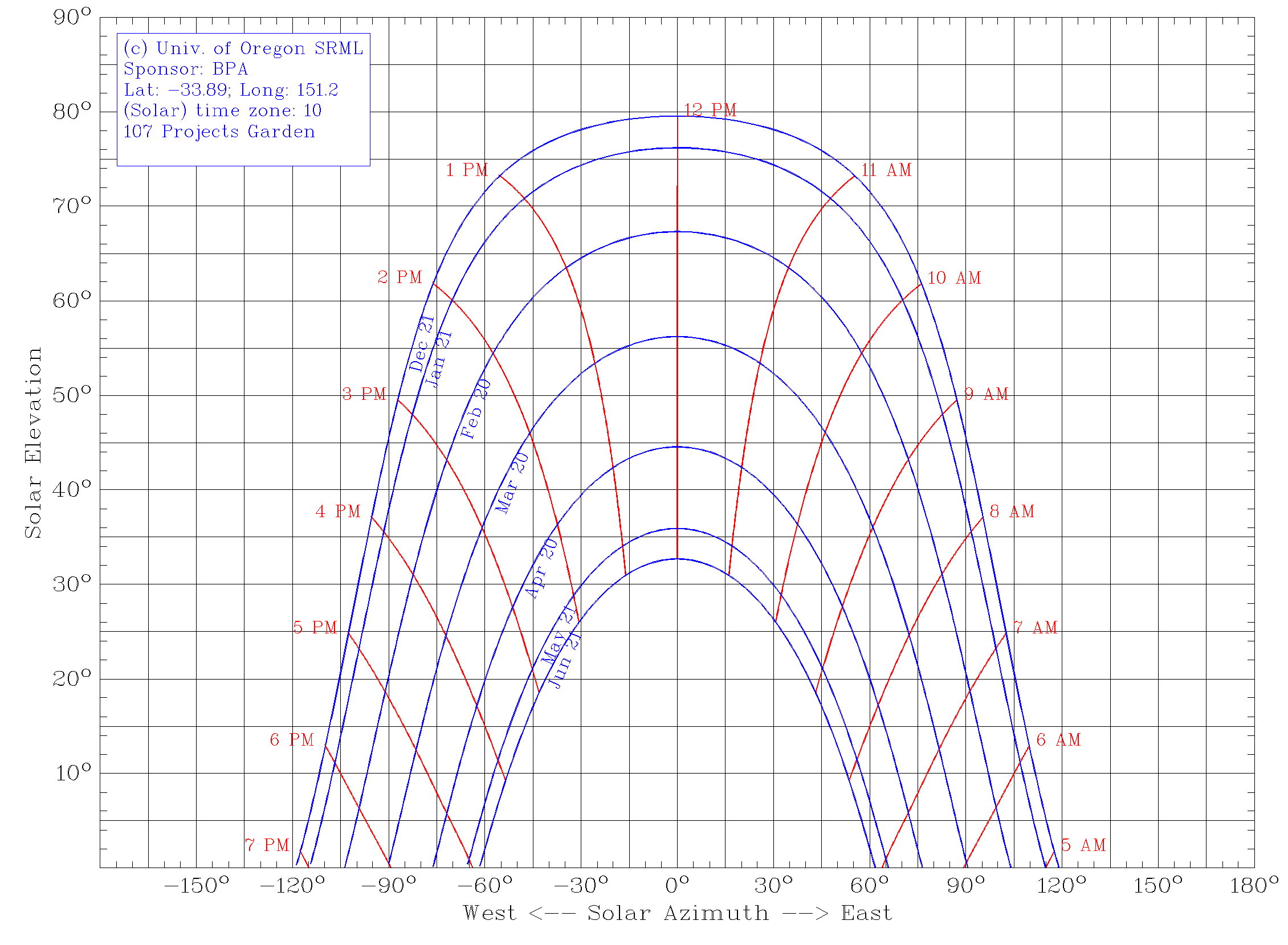
Sunchart – From the University of Oregon Solar Radiation Monitoring Lab. This one provides an easy to use tool to generate an accurate map of the suns path for your location.
Rather than a top down map view, this tool provides you with an accurate diagram of the suns exact Elevation and Azimuth for a selection of dates for the year.
Find my shadow – this online tool shows the sun’s position and shadow cast for the specific date and location you specified.
To help with the apps above, Tech Recipes has a great tutorial to show you how to find any sites latitude and longitude using Google maps.
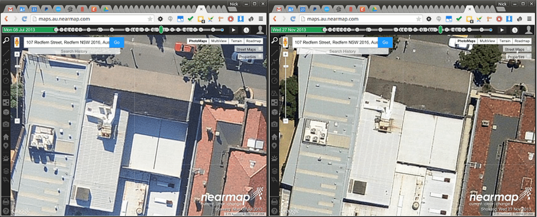
5. Use aerial photographs
If you have access to a regular series of aerial photos you can deduce a lot of information from the shadows. One great aerial photo service is Nearmap.
And a note that although access to Nearmaps’ commercial service is expensive, they do have a geographically restricted version available for non-commercially use for $99 per year.
6. Model your site in 3D
– Find My Shadow has a tool that allows you to make a simple model of your buildings and create a Bespoke Shadow Position Plot.
This is probably the easiest way to make a 3d shadow map of buildings.
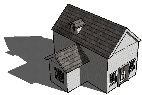
– If you are particularly keen you can create a 3D model of your site in SketchUp.
SketchUp comes with built in solar modelling and can show you exactly how the sun enters a building or garden. It is by far the easiest 3D modelling tool you will ever use.
It’s highly intuitive, if you are good with Adobe Illustrator of Photoshop it won’t take you too long to learn to model in SketchUp. There are lots of great SketchUp tutorials on YouTube.
The most visually appealing way we’ve seen to represent shadows and solar intensity is the Shadow Analysis extension for SketchUp.
It creates full colour representations of shadow intensity that clearly reveal areas that are baked by the sun all year round and areas that near feel it’s warmth.
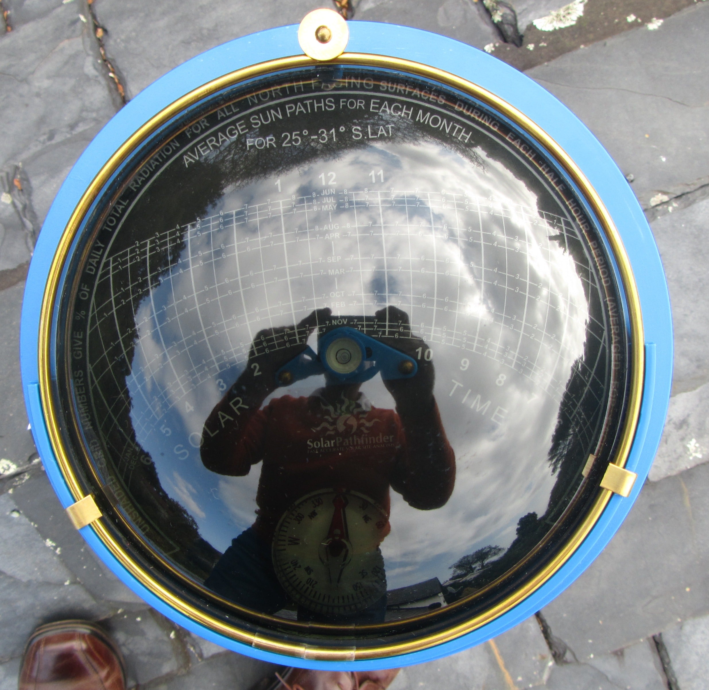
7. Use a physical tool
Probably the coolest tool you can use to find out how the sun affects your site doesn’t require a computer at all.
The Solar Path Finder uses a reflective dome to overlay a sun path graph with an image of structures that shade your site.
This video does a great job of showing exactly how it works:
So there’s a heap of tools to help you find how the sunlight falls on your patch. Happy designing!
Do you have any other ways to track the sun that we haven’t mentioned here? Comment below, we’d love to hear about them…


I’m working on a plugin for SketchUp which is more powerful than ‘Shadow Analysis’. It analyses the shadows over the entire year or a slice of the year instead of just one day. So you can, say, calculate a sunlight hours map for winter or between arbitrary dates. It can support deciduous trees and other dynamic elements. It can also produce a graph of sunlight hours for marked regions so you can see how the light varies at the point over the year.
You can see sample images at the Facebook page here:
https://www.facebook.com/suntrapsoftware
test
Fantastic Tim. When do you hope to release it?
It’s almost complete I just need to set aside a few days to polish it off and make a web site to promote & sell it. Will let you know!
Great… looking forward to it.
My system was really low tech. When we put another building on our suburban property I went outside each hour on a sunny day at the beginning of the month and mapped the shadow/sun edges – I did it for 6 months. This worked well as it caught all the shadows from neighbours trees, roof peaks etc. I found this very useful to work out when I could plan to plant in spring – I knew areas that the sun would reach in a month’s time – 6weeks etc. I was able to mark also how many hours of sun… Read more »
awesome.
My system was also very low tech. I live in a townhouse overshadowed by tall buildings and trees, so the sunlight is limited and patchy. I put numbered tags in every pot, in wall spaces, on balcony rails etc. Once a month I make hourly observations for each number so I can work out what spots get enough sun to grow anything edible. Anything with 3-6 hours sun is okay for salad greens and some herbs. Then I can reserve the precious few spots with 6 or more hours of sun for things like cherry tomatoes in summer.
I have beds on north side of my house and 3 m away on the opposite fence that are in shade in the winter from the neighbours house but baking in the summer and would love some recommendations about growing fruit trees along the fence, ie shaded in winter, is that okay?